5 Zoning in Hampton Roads
5.0.1 Data collection
Zoning data collection and analysis for the Hampton Roads region took place from April through August 2023. At this time, Gloucester County and the City of Poquoson were going through updates of their zoning ordinances. The findings and presentation of the Hampton Roads portion of the Virginia Zoning Atlas are a point-in-time representation of zoning ordinances during this time. This analysis also includes the Towns of Windsor and Surry.
The other towns in the region, Boykins, Branchville, Capron, Claremont, Courtland, Dendron, Ivor, and Newsoms, were not part of this analysis because their zoning map and/or zoning ordinance were unavailable to us.
Zoning and geospatial analysis contributions were made by Christopher Newport University students: Robert Bennett, Stephen Everard, Audrey Morrison, Orson Lange, and Layne Marshall. Eric Mai and Maria Dougherty were the project leads for the region.
It is the intent of the Virginia Zoning Atlas to track major changes to zoning ordinances and zoning maps with periodic updates.
5.0.2 Sponsors

5.1 Key findings
- Mixed with Residential zoning districts make up only 3 percent (3%) of total developable land in the region.
- Seventy-one percent (71%) of land in Hampton Roads is dedicated to single-family detached only housing zoning districts. In many localities, the percentage is much higher.
- Minimum lot sizes for single-family detached housing are highest in Gloucster, Windsor, and Poquoson, but many jurisdictions in Hampton Roads have a minimum lot size between 0.5 to 1.0 acre.
- The percent of land that you can build 2+ family housing is but a fraction of total developable land in most localities in Hampton Roads. Newport News (12%), Norfolk (11%), and Williamsburg (9%) stand out among their neighbors, but not by much.
- Two jurisdictions — Hampton and Poquoson — employ minimum square footage requirements for housing.
- All jurisdictions employ off-street parking requirements. For 4+-Family treatment, parking minimums range between 1 to 2.5 spaces depending on the number of bedrooms per unit. Some jurisdictions require additional spaces to account for visitors, while others do not.
- Accessory Dwelling Unit regulations vary greatly across the region, but many jurisdictions place significant restrictions on how they are used. Newport News and Chesapeake are notable for not allowing residential ADUs at all.
- There are numerous opportunities to upzone areas within a quarter mile of public transit routes in the region.
- Throughout the region, there are areas with more low-wage jobs than there is housing affordable to those jobs. More by-right 4+-family housing in these areas can support these essential workers and a diverse economy.
5.2 Zoning’s impact in Hampton Roads
With increasing housing affordability issues across the region, a diverse and growing supply of housing is needed to meet the needs of a diverse population. Localities have significant control over their supply through their zoning ordinances.
The following findings are based on the Zoning Atlas Methodology and takes into account the impact of federally-owned lands and wetland areas, which are both prevalent throughout the region. Like our colleagues in New Hampshire, we have sought to exclude areas of land that are not buildable. We have excluded all federal land from calculations, as well as area of wetlands and/or water that are 10 contiguous acres or more.
Federal lands were identified using ESRI Landscape’s USA Federal Lands feature layer, which accounted for lands managed by six federal agencies, including:
- Bureau of Land Management
- Department of Defense
- National Park Service
- US Fish and Wildlife Service
- US Forest Service
Camp Peary is notably missing from this data and was added on 10/13/2023. Thanks, Earl Anderson!
Wetland/water areas were identified using the U.S. Fish & Wildlife Service’s Seamless Wetlands Data. The wetlands polygon was used and allow polygons with an area of 10 acres or more were utilized as a mask layer to clip from our Hampton Roads zoning district layer file.
Overlay districts, which are districts that may change the regulations of a base zoning district, were not a part of this analysis. Few overlay districts in the Hampton Roads region affect the uses of the base zoning district.
5.3 Zoning ordinances in Hampton Roads
| Jurisdiction | County or equivalent | Government Type | Date of Zoning Ordinance | Number of Pages | Number of base and overlay districts |
|---|---|---|---|---|---|
| Boykins | Southampton County | Municipality | NA | NA | NA |
| Branchville | Southampton County | Municipality | 1982 | 32 | 3 |
| Capron | Southampton County | Municipality | NA | NA | NA |
| Chesapeake | Chesapeake | Municipality | 1993 | 620 | 47 |
| Claremont | Surry County | Municipality | NA | NA | NA |
| Courtland | Southampton County | Municipality | NA | NA | NA |
| Dendron | Surry County | Municipality | NA | NA | NA |
| Franklin (city) | Franklin | Municipality | 1994 | 132 | 19 |
| Gloucester | Gloucester County | County | 2023 | 154 | 16 |
| Hampton | Hampton | Municipality | 1960 | 328 | 57 |
| Isle of Wight | Isle of Wight County | County | 2005 | 468 | 21 |
| Ivor | Southampton County | Municipality | NA | NA | NA |
| James City | James City County | County | 1985 | 399 | 19 |
| Newport News | Newport News | Municipality | 1997 | 141 | 30 |
| Newsoms | Southampton County | Municipality | NA | NA | NA |
| Norfolk | Norfolk | Municipality | 2018 | 896 | 96 |
| Poquoson | Poquoson | Municipality | 1981 | 194 | 17 |
| Portsmouth | Portsmouth | Municipality | 2020 | 160 | 34 |
| Smithfield | Isle of Wight County | Municipality | 1998 | 499 | 20 |
| Southampton | Southampton County | County | 1990 | 253 | 16 |
| Suffolk | Suffolk | Municipality | 1999 | 427 | 30 |
| Surry | Surry County | County | 2013 | 239 | 14 |
| Surry (town) | Surry County | Municipality | 1981 | 40 | 5 |
| Virginia Beach | Virginia Beach | Municipality | 1998 | 348 | 43 |
| Williamsburg | Williamsburg | Municipality | 1991 | 446 | 19 |
| Windsor | Isle of Wight County | Municipality | 2015 | 148 | 11 |
| York | York County | County | 1995 | 251 | 25 |
Zoning ordinances see amendments made over the years that eliminate, add, or refine language to better meet the needs of the community. But comprehensive rewrites following a comprehensive planning process can help ensure that zoning regulations align with future land use goals and changing demographics. From the table above, you can see that several localities have updated their zoning ordinances in recent years, while others have not had comprehensive update in decades.
Subjectively, we found that many zoning ordinances had varying degrees of “readability.” We considered the language employed (i.e. did it overuse legal jargon?), the ease of which information needed could be found, and the use of images or graphics. Chesapeake’s zoning ordinance stood out to us as being overly complicated due to its use of a nontraditional use table. York County’s zoning ordinance was relatively straightforward.
5.4 Type of zoning district
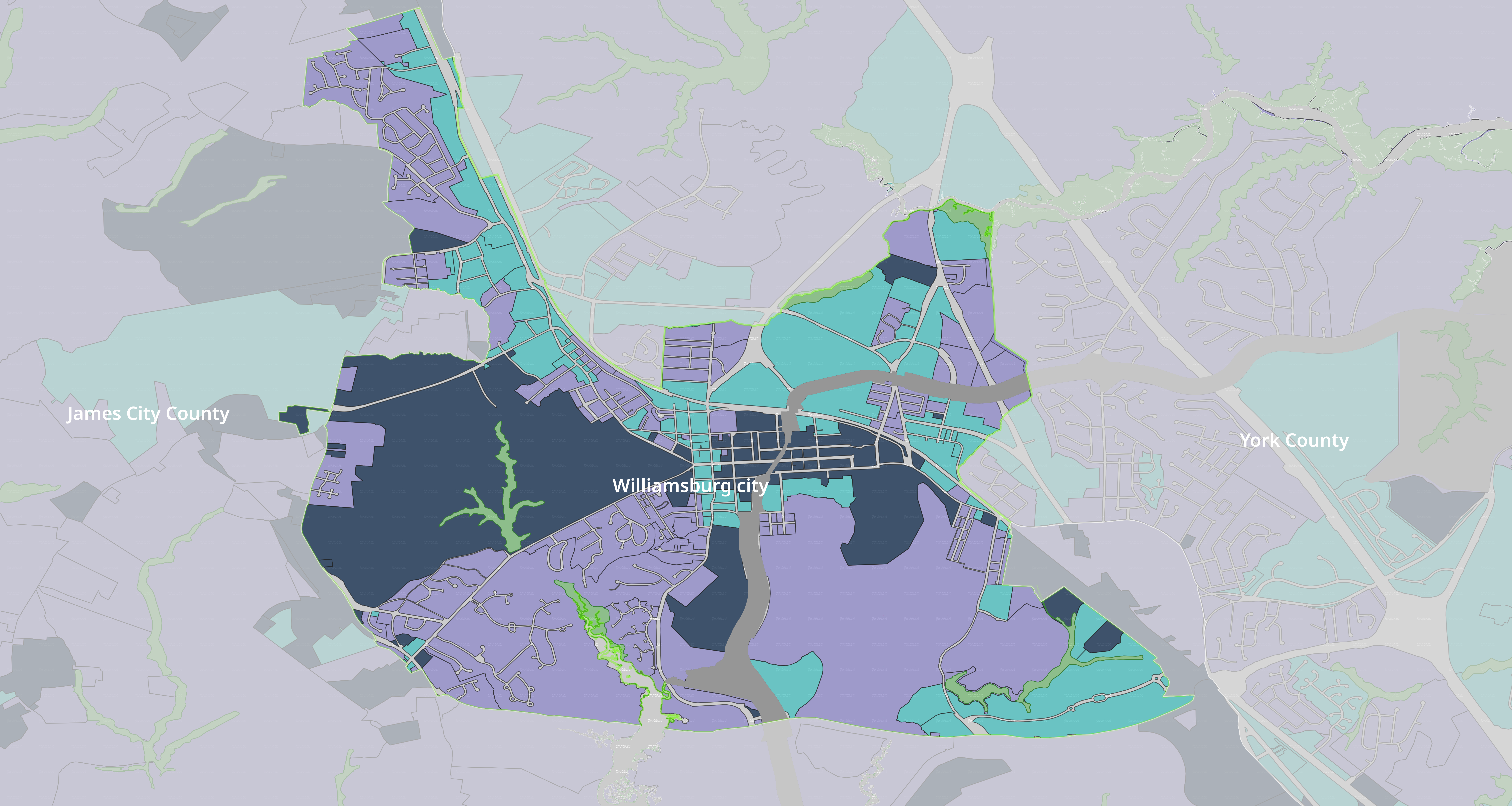
Roughly 91 percent of developable land is Primarily Residential . This includes prime agricultural land in the southern parts of Hampton Roads, where the preservation of open space and natural resources is a vital part of the region. Only three percent of the region’s developable land is classified as Mixed with Residential. Locally, Williamsburg (23%), York County (18%), and Newport News (12%) have the largest proportions of Mixed with Residential zoning types, while Surry County (0%), Southampton County (0%), and Isle of Wight County (less than 1%) have the least.
Williamsburg has the greatest percentage of Mixed with Residential zoning in the region.

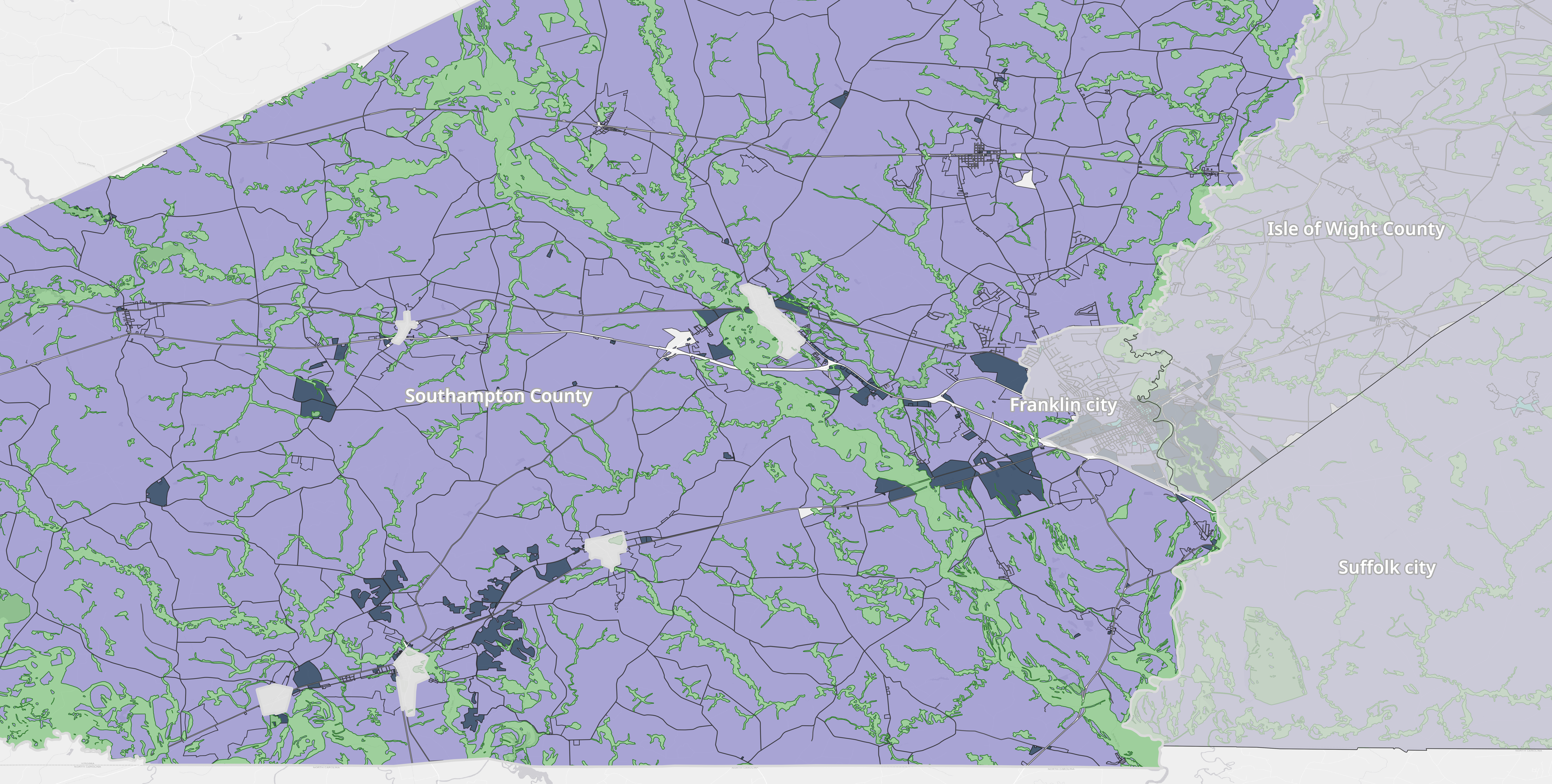
Surry County and Southampton County have no zoning districts that allow for a mix of residential and nonresidential uses.
In many rural localities like Surry and Southampton, mixed-use zoning is often implemented within older towns, which have their own zoning authority. Such as the case in the Town of Surry, where 7 percent of zoned land is Mixed with Residential.
Towns have historically been economic and cultural hubs for many rural communities. The Virginia Main Street Program is a resource utilized throughout the Commonwealth to revitalizing small and mid-sized downtown ares.
More recently, the Mixed Use on Main Streets (MUMS) pilot program was created as a joint effort between the Industrial Revitalization Fund (IRF) and Virginia Main Street programs to create opportunities for commercial development coupled with housing units.


Walkable, mixed-use communities are increasingly desirable among all age groups. The ability to reach work, shopping, and leisure activities within walking distance supports healthy communities, but also supports diverse local business and job opportunities (think of areas like like Ghent in Norfolk or the ViBe District in Virginia Beach). These neighborhoods have a mix of zoning districts, as well as single districts that allow for a diverse range of uses.
More rural and suburban communities don’t need to become a Downtown Norfolk or Virginia Beach Town Center to create walkable, mixed-use communities.
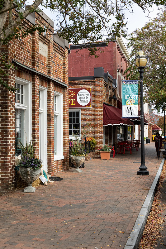
Towns like Smithfield, Virginia are a great example of density with a small-town feel.

Downtown areas in many cities across the nation have seen resurgences in recent years due to investment by local businesses and entrepreneurs. In addition, the construction of new housing or adaptive reuse of older buildings has also spurred the move to downtowns by people of all ages.
While there are constraints to downtown development in places like Newport News, increasing mixed-use zoning can help to create

5.5 Single-family detached housing
While single-family detached housing is a dream many aspire to, barriers to homeownership are making it difficult for many Hampton Roads residents to purchase a home. The previous section highlighted those challenges with current wages and high rental costs that are further limiting the ability to save for a home purchase. Furthermore, single-family detached only zoning can have major implications on equity and economic opportunity. Allowing for more diverse types of housing in single-family detached only zoning districts can help provide greater access to high opportunity areas for a diverse range of households - both in terms of race and ethnicity, and income.
